Friday, Jun 07, 2013 at 22:13
Hi
If you are using OziExplorer (PC) you don't need extra software. There are two ways to measure the straight line distance between two points
1. Fast way (no need to enter coords) - Open map that contains points of interest . Click on the "show the distance and bearing display" icon - click on the map at the two (or more) points of interest and the distance between them is displayed....you can display units in metric and non metric values (i.e km, metres, feet, yards
miles)
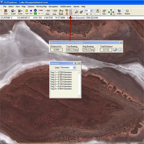
Ozi Distance
2. Slightly slower way (load waypoint file or click on map to create waypoints and edit coordinates to match what you need if required ....any coordinate system (UTM or Lat/long), any datum). Click on the "show distance between waypoint window" icon and select the two waypoints you would like to determine the distance between - BINGO!
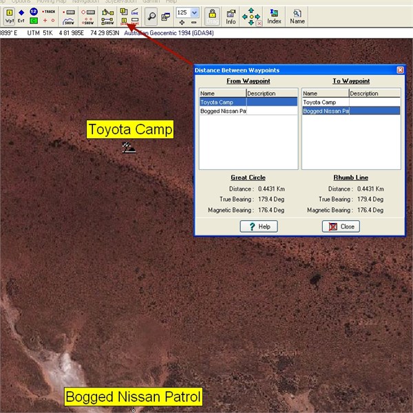
OziExplorer - Distance between two waypoints
Cheers
Greg
| I sent one final shout after him to stick to the track, to which he replied “All right,” That was the last ever seen of Gibson - E Giles 23 April 1874 Lifetime Member
My Profile My Blog Send Message
Moderator |
FollowupID:
791269