Friday, Jul 26, 2019 at 16:20
Here's a few screen shots that I took whilst offline last week travelling in outback WA on way to Karijini and around etc. All are offline.
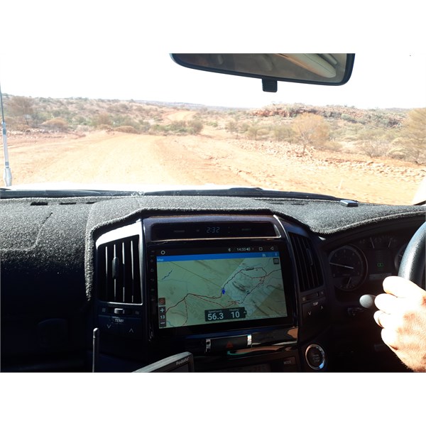
Look out window, see rock, now look at map see rock
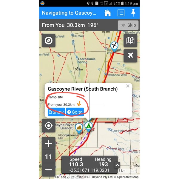
Offline - tap any Place to see your distance to it
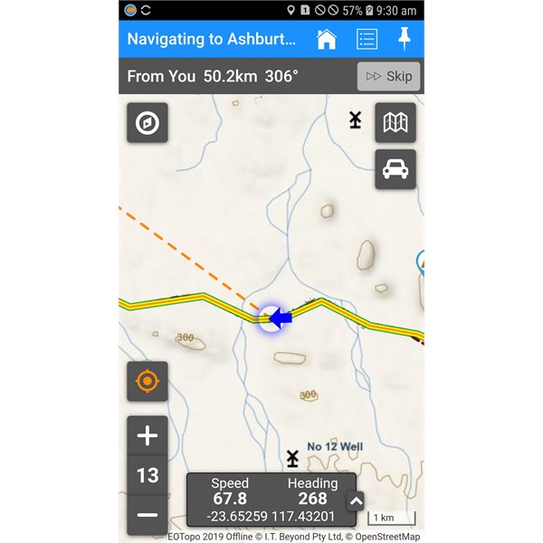
Offline navigation shows current location (blue arrow)
It is very easy to use the map when offline to find distance to anything you want - just press one of the
Places and as per the screen shot you get the info.
You can also build Private
Treks whilst online before you go if you specifically need routing guidance for every turn but I don't use that for general travelling - its good to do a bit of a plan, but if you deviate off the plan it's not so practical offline and if I do it, I only build Private
treks for 1 day's travel at a time so that the timing all makes more sense.
We always travel solo and we deliberately plan our trips to go to areas we have never been. The app helped us find perfect camps without any symbols telling us where to go. It's the topographic detail and minor tracks that is astoundingly useful. I don't choose to leave
campsite markers in
places that might change due to weather conditions - one
bush camp that is lush and perfect could be horrid in a few months time, but if people know how to use the maps to observe the terrain they can find their own camps just like we did. However, where there is a commercial
campground, sure we'll ensure this is listed as a Place but I probably wouldn't aim to
camp at any of these nowadays as they are full of other campers and that's not what we called ExplorOz - I just wish I had this level of mapping detail 20 years when we travelled for 2 years around Australia on our own - I wonder how we did it? LOL
On the issue of Wiki camps, I cannot understand how anyone can use these maps - totally useless! I think it is geared towards a different market and that's fine. We're not in competition with them. They aren't a map developer and its just lots of symbols on a blank screen most of the time for us so that's not much use. But if it is for others, that's fine for them. Its a free app for 7 days then you pay $8 or whatever. You get what you pay for.
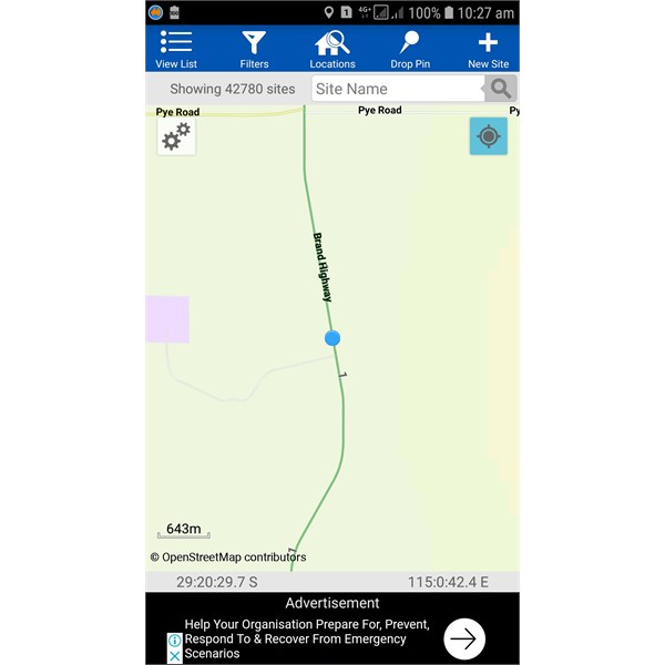
I took some comparison shots at same place so show what Wiki Camps shows vs
EOTopo (used in
ExplorOz Traveller). See these below -
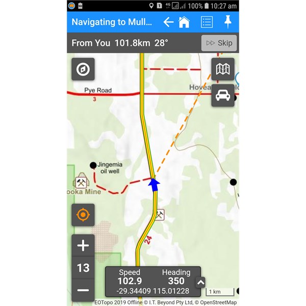
Screen shot comparison EOTopo map in ExplorOz Traveller
Comparison screen shot showing Wiki Camps
As you can see, same exact place but nowhere near the detail in Wiki camps as what you get on
EOTopo. It was like this everywhere. I just gave up comparing, it was obvious to me it was useless.
EOTopo maps in our app show topographic map data to actually see the terrain and get a feel for where you are about to find a great river bed, or a
rock - we discovered many great sites that are not listed on the maps - not on Wiki Camps, not even as
Places in our app but that's the ideal situation because the reality of outback travel is that things happen and plans change - for us from day 1 my Private Trek plans went out the window as we had a fire and didn't make our first night's destination and had to readjust our next few days to reach our booking at Karijini 5 days later - but all good - we used the app to look for upcoming river beds, and interesting pois to help us as all my destinations were not achievable as soon as we got out of whack. In the end it was a blessing in disguise - we had much more open fires and really enjoyed ourselves.
Whilst it was a much needed family holiday, it was work the whole time for us too. We did a lot of testing - had the app loaded on 5 different devices, iPad, 2 Android phones, and our indash Android unit (Teyes) - wow it is just such an amazing device. The app worked perfectly on all devices - not a single glitch and perfect tracking the entire time (see our track log here -
Karijini Family Trip - Track Log) however, I did find many areas of improvement needed in the app and a few small bugs were reported via email to us whilst we were away which we've amalgamated into a hit list.
First we dealt with bugs - which we fixed in a new update released yesterday v3.8.2 and all the new features David will do in the next update (perhaps 1-2 weeks) - sadly he has had a family emergency and the day after coming
home, had to fly interstate to be with his elderly parents both in their mid 90's.
I've been testing v3.8.2 and the issues we knew about are fixed and now its just a matter of adding all the new features and adding tweaks, improvements I found were needed to make it even better.
Thanks for all those supporters of
EOTopo maps and
ExplorOz Traveller app. The more support we get, the more financial ability we have to continue development. Our business is only run by the two of us - we have no staff and we don't use any offshore developers, this is all done inhouse. We are very responsive to
feedback and try to be as helpful as possible with technical support but most times people do just need to read the help/instructions and try using it and stop stressing about making
treks. The app does everything offline and you don't need to pre plan as much as people think.
I think my main job now is to create more tutorials (and get better at it, they are so time consuming and hard to do). I'm not very good at it I think but I try. We just don't have the budget to get the professionals onto it, so sorry you have to make do with me!
AnswerID:
626879