Article Comment: About Us
Submitted: Monday, Jul 15, 2019 at 10:28
ThreadID:
138723
Views:
4077
Replies:
3
FollowUps:
0
This Thread has been Archived
Mark W38
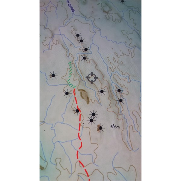
G'day. Love the maps. There's one symbol - a black 'sun' - that appears on the map, especially when we start heading west from the FNQ coast. What is this indicating on the map? I can't seem to find this symbol in the legend. I've attached a photo if it fyi. Any help would be greatly appreciated. Thanks, Mark

Black sun symbol
Reply By: Member BarryG - Monday, Jul 15, 2019 at 15:02
Monday, Jul 15, 2019 at 15:02
Hi Mark,
Can you give an approximate location or lat/long?
Barry
AnswerID:
626743
Reply By: kgarn - Monday, Jul 15, 2019 at 15:14
Monday, Jul 15, 2019 at 15:14
It looks like the "Pinnacle" symbol as defined by GeoScience Aust in their Symbol Dictionary for Topographic Maps.
Ken
AnswerID:
626744
Reply By: Member - Warren H - Monday, Jul 15, 2019 at 16:57
Monday, Jul 15, 2019 at 16:57
Looks like they are marking the 'pointy'
limestone outcrops around
Chillagoe, so I guess in mapping terms they are
pinnacles.
AnswerID:
626748