Tuesday, Oct 17, 2017 at 22:16
Perry, it certainly is, just takes a bit of guts and an occasional stroll to find the track lol.
Here is some text from a post I did some time back. It covers the track heading into Rudall from the east so you'll need to consider it in reverse. Video and blog link are below also.
The actual post with a few photos is here -
Rudall from the west
"The track in is usually
well defined from
Christie Crossing to Bocrabee. From there it can be problematic as you move further east. It continues past Bocrabee to the south for 2 km and at a point (22°30'39.62"S 121°24'55.86"E) you should be able to pick up the track heading east through the dunes.
Eight km east you should come to a
track intersection (22°31'37.41"S 121°29'31.03"E) . DO NOT take the top track – It disappears into a creek now 4m deep. Instead bear south for about 350m to a crossing point (22°31'47.76"S 121°29'26.99"E).
From here it gets a bit problematic for a few km. The area is a laterite soil plain which means that after a good rain, the water will sheet and tends to wash away most of the tracks. It’s happened to me when we went through in 2009 and 2010 and in 2012. We had to make our own tracks each time. You could
well have been following our tracks back in 2010!
Have a look at this spot on Google earth (22°31'52.64"S 121°30'45.20"E). From here you’ll see a scrub band heading to then NE at 67 degrees for 2 km. You want to try and stay on the southern side of it. 1.2 km east of this point is a large stone cairn (22°31'48.76"S 121°31'23.28"E) at the edge of a grassy plain. If you can get to that, head across then plain at 77 degrees for 2.5 km and you should be able to pick up the track on the other side (Here’s a spot to aim for 22°31'29.74"S 121°32'56.61"E ).
From there it’s largely as you remember it. A bit rocky, a few plains, a creek or two and the rocky staircase down to Tchuck
Pool. The only other problematic area is the
creek crossing 4km south-ish from
Hanging Rock. It gets washed a way to so you’ll need to walk across to the other side to find an exit point.
Enjoy the trip. Great part of the world.
Mate feel free to MM me or flash off an email to Mickolsen13@gmail.com with any specific questions or if you'd like a GPX file of the route.
Cheers
Mick
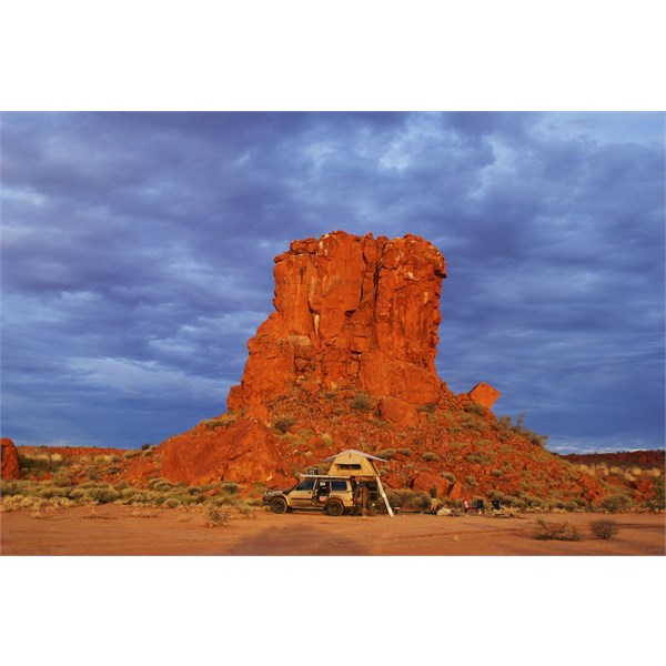
Camped at Hanging Rock
Blog is here: -
Journey to Rudall River via the Oakover Country
AnswerID:
614403
Follow Up By: Mick O - Tuesday, Oct 17, 2017 at 22:26
Tuesday, Oct 17, 2017 at 22:26
Found Part 2 which continues the journey on to
Hanging Rock and the rest of the route into Tjarra
Pool and DQB. Holpe to be out there again next year myself.
Cheers.
FollowupID:
884999