Thursday, Apr 20, 2017 at 20:34
Hi Marndee
Sorry for the late reply, but have been away and back to work now.
Like many people, I thought that
MacCabe Corner would be the 3 states official joining marker, but in fact it is not.
The reason for this lies in one point that you mentioned and a fact that I was aware of. NSW owns the
Murray River and the Southern Bank then becomes the actual State Border of Victoria. So at the point over 400 metres further upstream from
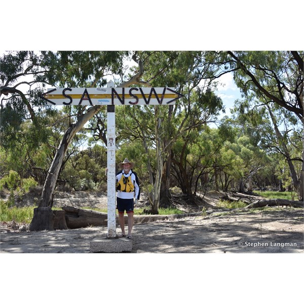
MacCabe Corner is the actual State Border Marker for South Australia and NSW, and it is at this point where any land to the south is then Victorian.
As for the actual Victorian State Border Survey that was a complete shambles, it was tested in the High Court in 1914 and for some very strange reason, Victoria won the court case and South Australia lost 138,700 hectares of land through no other fault as very bad Surveyors in 1847 to 1850.
For this very reason, and to stop the Victorian so called Border Heading north of the
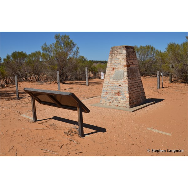
Murray River, and proven by the the fact that the actual Border was 3.2 kilometres west of the actual Meridian, Charles Todd was appointed in 1868 to determine the actual correct position of the 141st Meridian and after the position was confirmed, Todd met with the NSW Government Astronomer, George Smalley where it was confirmed that Todds action position was correct and at this remote location, a large brick Obelisk was built to mark the correct position at the SA / NSW Border, and with todays modern survey equipment the position as determined back in 1868 is only out by around 100 metres, compared the the 3.2 kilometre stuff up by the Victorian.
Here are a couple more shots that relate to the area.
Cheers
Stephen

This is the actual position of the SA/NSW Border

MacCabe Corner lies more than 400 metres down stream from the SA/NSW Border

This is Charles Todd's Obelisk that marks the correct position of the 141st Meridian and was built in1868
FollowupID:
880314